
Extraction of buildings and road networks from Satellite Images
Machine Learning ·Keywords: Python, Tensorflow, Keras, Pytest
Repository: Building and Road Segmentation
![]()
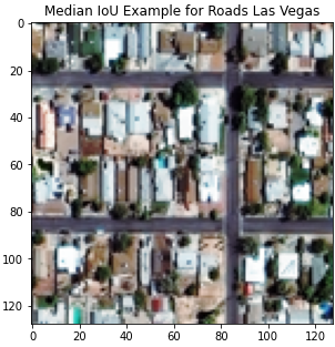
Below we display an example of an input image and the corresponding ground truth and predicted road network and building footprints.
Input Image
Predicted Labels
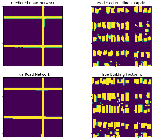
Humanitarian and natural disasters can impact roads and buildings, and having a tool that can quickly survey them is useful. For this reason, I extract buildings and road networks from satellite images using Tensorflow and UNet archtectures.